|
The
roads leading to Bint Jbeil are: the sidon-Tyre-Cana-Bint
Jbeil road; the Sidon- Tyre-Naqura-Rmaysh-Ayn Ibl-Bint Jbeil
road; or the Marjeyun-Mays al Jabal-Aytarun-Bint Jbeil road.
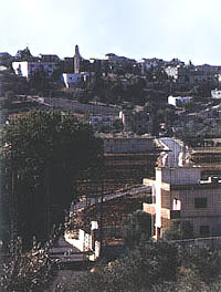
Bint Jbayl, the chief town of the Caza, is
located on a hill overlooking the valley of Rmaysh, near the
southern Lebanese border. Under
the rule of the al Saghir family, it was the center of the
whole area. From this
period, remains of an old serail and of a 19th century mosque
survive. One of the
main features of this locality is its weekly market held each
Thursday and visited by traders from the region.
|
|
|
Continue to
Baraashit, which lies in the midst of tobacco plantations and
where you can visit caves and wells.
The site known as al Hara hides under its ruins a very
important ancient settlement.
Continue to the north-east, across the tobacco
plantations to the village of Shaqra (11 km), famous for its
modern mansions and buildings.
In the old South Lebanon, the visitor can see rock-cut
tombs from different historical periods.
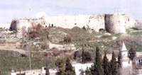
Next to the village, on a hill overlooking the whole
area, stands a small fort known as the fort of Dubiyye, a
distorted form of the French name “Dubois.”
Crusader building erected on the remains of a
Roman temple, as attested by the large stone blocks and the
rock-cut tombs next to it. A
rectangular monument with three floors, its southern part and
its upper third floor have been totally destroyed by
continuous Israeli bombardments.
The remaining first and second floors consist of some
thirty rooms with several wells.
Leave Shaqra and go west to the villages of
Safad al Battikh, al Jumayjme and Ayn al
Mizrab. Turn right
to go to the villages of Sultaniye and Dayr Antar
(17 km). In the
latter, several archeological finds have been discovered.
Many old cisterns hewn in the rock are still in use to
this day.
High up on the village
summit lies a rocky platform known among the locals as the
“Crypt of the Prophet.” On
it are printed the feet, the hands and the forehand
of a human being.
These have been
interpreted as the traces left by a person in an attitude of
prayer. The
inhabitants of the village built a mosque next to the
platform, which has become a holy place sought by people for
blessing. South-west of
the village is a famous natural grotto known as Mgharet al
Bzez. Similar to the Jeita Grotto, the visitor can walk inside a long
distance to admire its stalactites.
|